Mountains and Mountain Building
Updated on 05.05.15

Poorna's Pages at the Glendale Community College
|
|
Mountains and Mountain Building |
Welcome to |
Updated on 05.05.15 |
|
|
Poorna's Pages at the Glendale Community College |
||||
You may need to download the Adobe Acrobat Reader to view this PDF file |
|
|
|||||
|
Click on
the image above to browse the PDF
version of USGS publication "Birth of the Mountains: The Geologic Story of the Southern Appalachian Mountains" |
|||||||
|
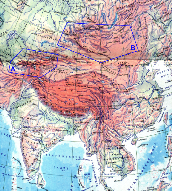
Click on this map of Asia in order to browse an interesting research paper (PDF) on measuring the crustal shortening in Central Asia |
|||||||
| Southern California Mountains and Seismicity | |||||||
|
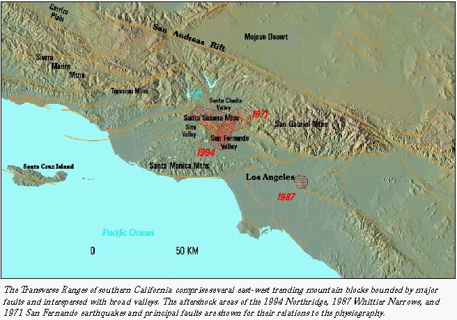
The Transverse Ranges of Southern California, as can be seen in this map, comprise a number of east-west trending mountain blocks bounded by major faults and interspersed with broad valleys. The aftershock areas of 1994 Northridge, 1987 Whittier Narrows, and 1971 San Francisco earthquakes and principal faults are shown for their relations to physiography. |
 |
||||||
| Source: | |||||||
| http://pubs.usgs.gov/of/1996/ofr-96-0263/p22study.jpg | |||||||
|
Poorna's Web Notes Mountain Belts and the Continental Crust |
|
Locally, mountains can be
simple topographic features that form by differential erosion, folding
and/or faulting, volcanism etc. Our interest here is on a broad regional
scale, however. |
|
|
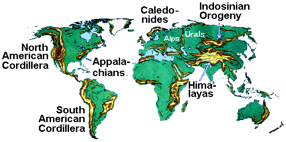
Mountain belts
World’s major mountain
ranges were created
|
|
|
The major mountain belts worldwide ...
|
Folded mountain belts are believed to evolve in three main stages:
the uplift or block-faulting stage of “isostatic readjustment” and normal faults and block faulting;
the accumulation stage creates a thick pile of mostly marine sediments and volcanics;
the orogenic stage of intense deformation made up of folding accompanied with reverse and thrust faulting and followed by metamorphism and/or plutonic emplacements); and
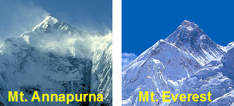
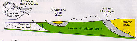
The Example of Himalayas
|
Himalayas display all these characteristics. Of the two peaks shown alongside, the one on the left, Mt. Annapurna, is made up of limestones (i.e., marine rocks) with ~200 Ma old Ammonite fossils. These suggest that a deep ocean then existed here. The peak shown on the right is Mt. Everest, the world’s tallest peak. It is a gneissic (a metamorphic rock) dome. As for the crustal thickness, gravity and seismic studies confirm the crust beneath the Himalayas to be <70 km, compared to 30-35 km thickness of the average continental crust (click on the picture to read about the Himalayas). |
|
|
|
 |
|
Taken from "Initiation of the Himalayan
Orogen as an Early Paleozoic Thin-skinned Thrust Belt" by G.F. Gehrels, P.G.
DeCelles, A. Martin, T.P. Ojha, G. Pinhassi and B.N. Upreti: "GSA Today",
vol. 13, no. 9, pp. 4-9 (Sept. 2003). |
|
|
90 million years ago India rifted away from Madagascar and began its rapid movement northward, ultimately colliding with Asia between 55-50 million years ago. During the late Cretaceous (80 - 65 mya), India was moving at rates of more than 15 cm/year. No modern plate moves that fast. India's northward race towards Asia may be something of a plate tectonic speed record. The reason it moved so quickly was because it was attached to a large oceanic slab of lithosphere that was subducting beneath the southern margin of Asia. As India moved northward a string of islands were created along its southeastern trailing edge. These islands form the 90 E Ridge and were generated at the Kerguelen hotspot (just southwest of Australia). |
|
After India collided, Australia was released from Antarctica and
it began to move northward towards S. E. Asia. Australia is currently in
collision with Asia. In the future we can expect Australia to continue moving
northward, rotating counter-clockwise as it swings past Borneo and arrives at
China's doorstep.
(www.scotese.com/indianim.htm) |
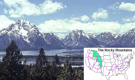 |
Rocky Mountains Shown on the left is a view of Northern Teton Range in the Rocky Mountains. Click on this picture to visit the USGS/National Park Service website that this picture has been taken from. |
|
Try these virtual excursions The picture on the right shows Nanga Parbat, the fastest rising ranges in the Himalayas. Clicking on it will take you to Bob Taylor's site at the University of Leeds for a virtual excursion to the Himalayas. |
 |
||
 |
Click on the picture on the right for a virtual excursion to the Alps, that on the left for sub-Alpine virtual trip, both at Bob Taylor's site at the University of Leeds. |
 |
|
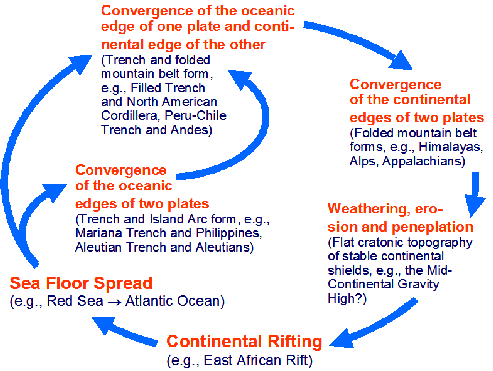
Plate tectonics ascribes mountain building to convergent plate motions, which provide the required compressive forces in the orogenic stage, and thus distinguishes between:
the collision mountains like Alps, Himalayas and Urals, which involve the convergence of continental edges of plates; and
the cordilleran mountains like the Andes which involve the convergence of continental edge of one plate and the ocean edge of the other.
The "Wilson Cycle:
Thus, Wilson Cycle, shown below, identifies mountain building as the culmination of a process that begins with continental rifting, so completing a cycle that lasts for 250-400 Ma or longer, judging from the example of the Appalachians that probably closed a >400 Ma old version of the present Atlantic ocean.
Click here to learn more about the Wilson Cycle