Welcome to Poorna Pal's 'Earth Revealed' telecourse (Geology � 101: Physical Geology; section #7695) at the Glendale Community College

Earth's Oceans
|Module 1 Home 05/05/15
Home | Quizzes | Module 1 | Module 2 | Module 3 | Module 4 | Module 5
|
|
Welcome to Poorna Pal's 'Earth Revealed' telecourse (Geology � 101: Physical Geology; section #7695) at the Glendale Community College |
|
||
|
Earth's Oceans |
||||
|
|Module 1 Home 05/05/15 |
||||
|
Home | Quizzes | Module 1 | Module 2 | Module 3 | Module 4 | Module 5 |
||||
![]()
|
Help available 'Online' |
|
Help available at this site |
|||||
|
|
|
You may need to download the Adobe Acrobat Reader to view this PDF file |
||||
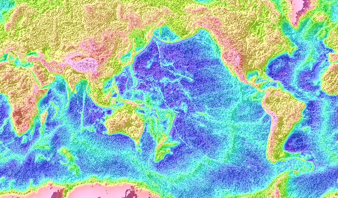
| Click on this map to browse the NASA map of world ocean floor. |
 |
||||||
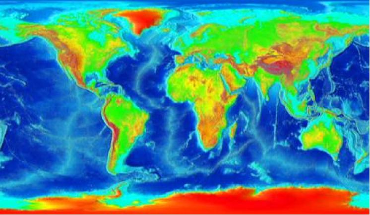
| Click on the map to browse the HRW ocean floor atlas |
 |
||||||
|
|||||||
|
|
|||||||
|
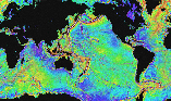
Click on the image below for the interactive high resolution image of global ocean bathymetry at NOAA (National Ocean & Atmospheric Administration) Laboratory for Satellite Altimetry.
|
Clicking on the image below will take you to the NGDC (National Geophysical Data Center) 2- minute latitude/longitude grid (1 minute of latitude = 1 nautical mile, or 1.852 km) color relief images of the earth's surface.
|
|
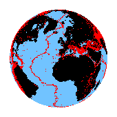
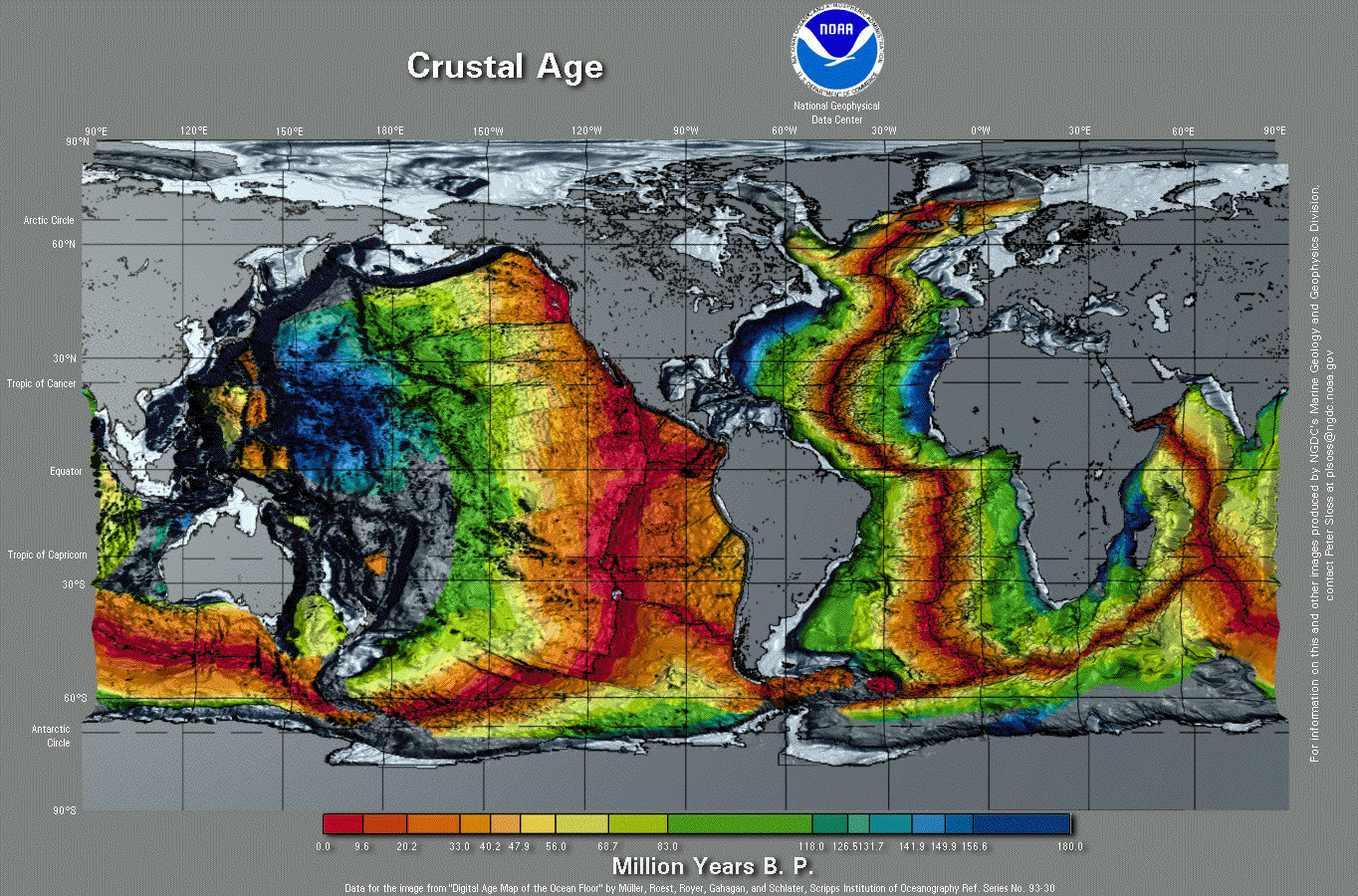
Clicking on the map alongside will enable you to view and download the original digital map of ocean floor ages from the NGDC (National Geophysical Data Center). Sea-Floor Spreading and Subduction Model This USGS Open-File Report 99-132 (On-Line Edition) by John C. Lahr describes how to build a model of the outer 300 km (180 miles) of the Earth that can be used to develop a better understanding of the principal features of plate tectonics, including sea-floor spreading, the pattern of magnetic stripes frozen into the sea floor, transform faulting, thrust faulting, subduction, and volcanism. North Cascades Geology: Sea-Floor Spreading This USGS page compares magnetic stripes on the sea floor to the magnetic reversals in basalt on the land as seen in a vertical cliff and explains how this supports the sea floor spread model. Click on the title below to read David Sandwell's article 'EXPLORING THE EARTH FROM MARS'. |
 |
Note: Rotating globe at the top left corner of this page is from http://adinet.net/Globe_HTML/frames/scientific/f2p3a7_78kb2.htm
This site was last updated 05/05/15