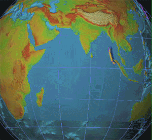
The Dec 2004 Indian Ocean tsunami was produced by perhaps the
strongest earthquake of the past 100 years. It occurred in the Java trench,
off Bandar Aceh in north-western Sumatra.This image is
a work of the
National Oceanic and Atmospheric
Administration
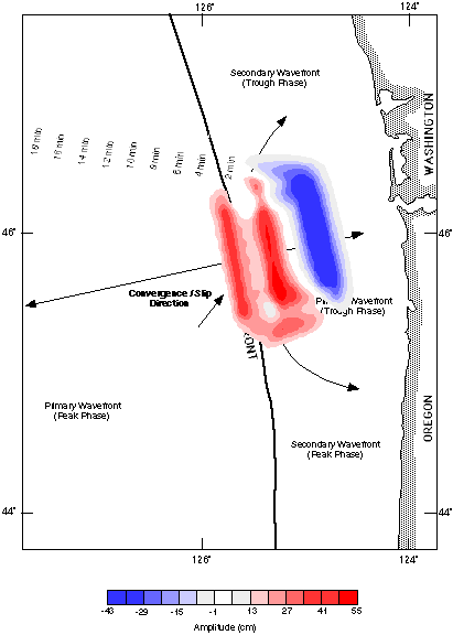
Seismicity at the Filled
Trench offers the most likely scenario of the western U.S. facing the kind
of disaster that the Dec 2004 Asian tsunami, caused by the magnitude 9+
Sumatra earthquake of Dec 26, 2004, wrecked on the Indian Ocean coasts.
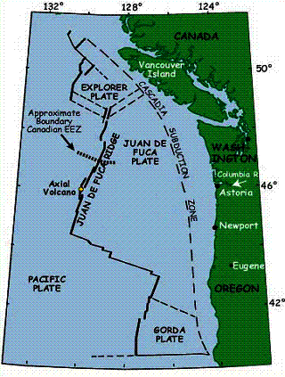
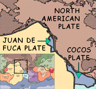
Juan de
Fuca ridge and the associated plates and
plate boundaries off the Pacific North-east and Canada. Note that the
Cascadia subduction zone is also called the “Filled Trench”, as this trench
got filled by sediments carried by the huge runoff from land that has
characterized this region particularly since the Last Ice Age.
Plate Tectonics:
Continental Drift, Sea Floor Spread,
Convergent Tectonism etc.
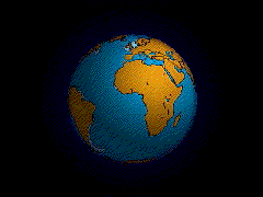
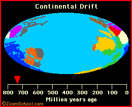
This USGS animation of
Wegener's "Continental Drift" postulate ...
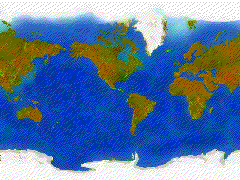
begins with view of Earth with
continents in their present positions,
continents move back in time to reunite
as Pangea and the Pangea label appears, and then the
locations of stratigraphic and
fossil evidence that Alfred Wegener used to argue in proposing his
postulate of continental drift are added.
Farallon plate is not what we can now see
for, much like Wegener's Pangea, most of it has subducted beneath North
America. It's only parts that still remain exposed are the micro-plates (?)
'Juan de Fuca' and 'Cocos'.
USGS animation of how the sea floor
spreads by intermittent volcanism at the mid-ocean ridge (right).
This results in the recording by
subsequent lavas of the geomagnetic polarity reversals (bottom right) and
the resulting marine magnetic anomalies can be mapped by magnetometers towed
by ships (bottom left)
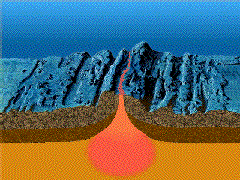
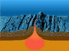
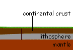
Active plate boundaries (i.e., the plate
boundaries where the Earth's surface area changes) can be either 'divergent'
(e.g., mid-ocean ridges, where new surface is created) or 'convergent'
(e.g., where existing surface is lost, either at folded mountain belts, or
at the deep sea trenches, or both, depending on the kinds of plate edges
that are converging).
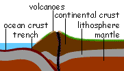
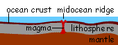
These three animations show how
these boundaries form:
the ones on the right show
convergent plate boundaries (top: folded mountain belt, bottom: deep sea
trench and folded mountain belt) and
the one below shows the
formation of a divergent plate boundary.
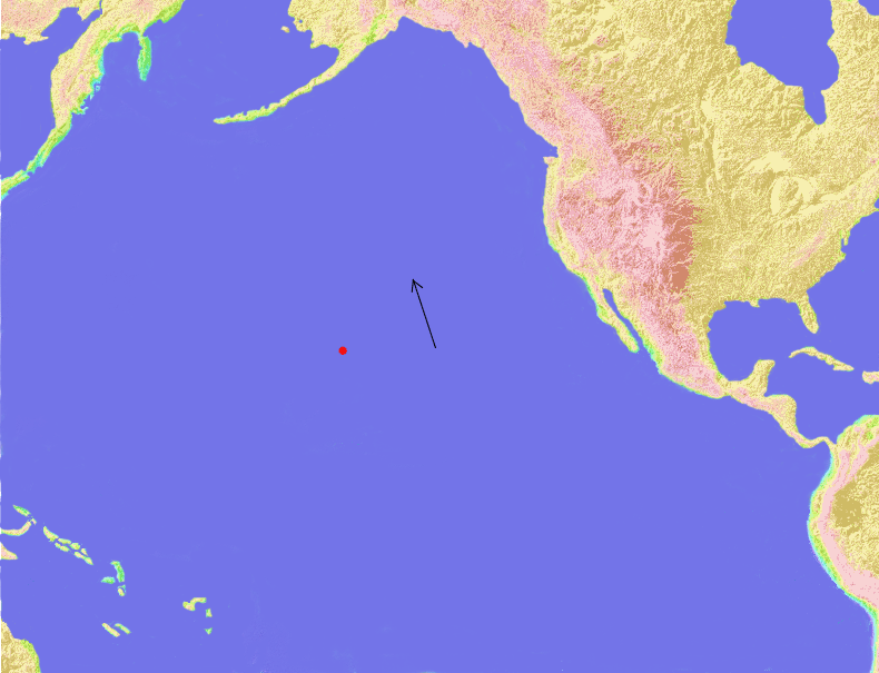
Animation and History
of the Emperor Seamounts and Hawaiian Islands
This animation shows the
formation of the Emperor Seamounts and the Hawaiian Island archipelago. The
arrow indicates the relative direction of the Pacific plate. Note the
direction of the plate changes at about 43 million years before the
present. The Pacific plate is currently subducting under the the North
American plate forming the Aleutian trench just south of Alaska and the
Kuril trench just east of the Kamchakta Peninsula. Eventually, the Emperor
seamounts and the Hawaiian islands will subduct and disappear into the
mantle. Note the position of the plates in the image below. Note that this
animation simply implies plate movement, the actual Pacific plate is
spreading out from the East Pacific rise, some 3,000 miles east of South
America.