-
USGS Pasadena Earthquake
Information. A comprehensive site, with current California earthquake
information, earthquake commentary, GPS monitoring, ground motion shake maps,
and a very complete list of links to other important earthquake sites on the
web.
-
USGS National
Seismic Hazard Mapping Project. Hazard maps for the United States;
answers to frequently asked questions; current earthquake information; damage
photos, and more.
-
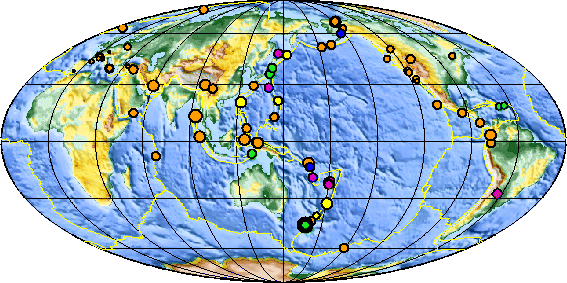
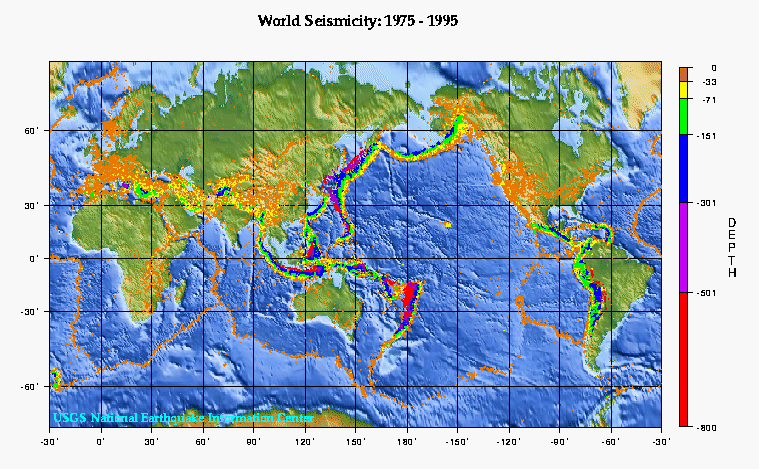
The Great Globe
Gallery. More than 200 global maps of the Earth, including crustal
boundaries, earthquake centers, volcanic eruptions, the Pacific Ring of Fire,
plate tectonics, world seismicity, and more.
-
Searchable
Database of Earthquake Photos. From the National Information Service for
Earthquake Engineering at UC Berkeley. Search for photographs of damage from the
earthquakes discussed in the textbook. Note: Search will return "no results"
unless you specify the location first (e.g., "Alaska 1964") rather than the date
first (e.g., "1964 Alaska"). There is also an
alphabetical
list of earthquakes with images in the database.
-
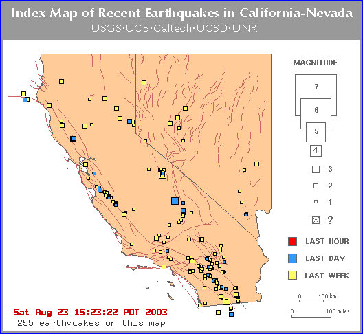
Map of Recent Earthquakes
in California and Nevada. Produced by the Southern California
Seismographic Network, a joint project of the USGS and Caltech.
-
A Decade of Notable
California Earthquakes. Includes maps, photographs, and information
about each quake. There is also a map of potential future earthquakes for the
next five years.
-
University
of Washington Seismology and Earthquake Information. Catalogs and maps
of recent earthquakes in the Pacific Northwest, the United States, and
worldwide.
-
Redwood City Public Seismic Network.
Many resources for amateur seismologists, including a map of Public Seismic
Network stations worldwide, earthquake data files, software to calculate bearing
and distance, and links to other useful sites.
-
Southern California Earthquake
Center. Extensive resources, including a map of the latest California
earthquakes and a
Seismicity Viewer that allows you to view animations of Southern
California seismicity by month.
-
ABAG
Earthquake Maps and Information. Association of Bay Area Governments.
Ground shaking hazard maps and animation for Bay Area cities, liquefaction
hazards, mitigation techniques, and more.
-
Canadian National
Earthquake Hazards Program. This site covers seismic events in Canada.
Includes lists and maps of recent earthquakes in Canada, reports on significant
recent earthquakes, articles on earthquakes in western and eastern Canada,
questions and answers about earthquakes, and information about earthquake
hazards.
-
Earthquake Information.
Australian Geological Survey Organisation (AGSO). This site has reports on
recent Australian earthquakes, earthquake and seismic monitoring station maps,
and an earthquake slide set.
-
Earthquake Engineering Research Institute.
The EERI is a national, nonprofit technical society of engineers, geoscientists,
architects, planners, public officials, and social scientists. The Institute is
best known for its field investigations and reconnaissance reports detailing the
effects of destructive earthquakes. EERI's web site includes news, earthquake
reports, earthquake links, and more. The society offers slide sets for a number
of earthquakes, and sample images can be viewed online. Good coverage of
earthquakes outside the United States.
-
The
Restless Planet: Earthquakes. From Savage Earth Online, a web site to
accompany the PBS television series. Excellent illustrations, animations, and
videos.
-
Virtual Earthquake is an interactive Web-based program designed to
introduce you to the concepts of how an earthquake epicenter is located and how
the Richter magnitude of an earthquake is determined. California State
University at Los Angeles.
-
Earthquakes. The Tech Museum of Innovation. A well-illustrated,
comprehensive introduction to earthquakes. Covers plate tectonics, seismographs,
faults, the propagation of earthquake waves, earthquakes in history, earthquake
safety, and much more.
-
Earthquakes. USGS
publication. Covers earthquakes in history, where earthquakes occur, how
earthquakes happen, measuring earthquakes, volcanoes and earthquakes, and
predicting earthquakes.
-
Earthquakes.
Southern California Integrated GPS Network Education Module. A good introduction
to earthquakes with information on the different kinds of earthquakes, their
causes, detection and measurement, and more. A Shockwave plugin is needed to
view the animated illustrations.
-
Earthquake Information at Humboldt State University. Includes a wide
variety of resources on the earthquakes of northern California: lists and maps
of recent earthquakes, basic information on earthquakes and plate tectonics,
information on living with earthquakes, data about tsunamis for those living
along the coast, and links to other earthquake information centers on the web.
-
Understanding
Earthquakes. University of California at Santa Barbara. Includes Java
animations of earthquake locations on a rotating globe and how earthquakes
occur, historical accounts of famous earthquakes, a short history of seismology
before 1910, and an earthquake quiz.
-
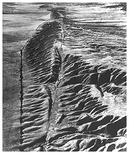
The San Andreas
Fault. USGS publication. Covers what it is, where it is, its surface
features, and the earthquakes that have occurred along it.
-
Susan Rosenberg's
Quaking Home Page. A comprehensive site including maps of current
earthquake activity; relief maps of the world, California, and the East Pacific
Rise; "a decade of notable California earthquakes"; historical earthquake maps
and links; and links to worldwide earthquake resources.
-
Earthquake Information Network
(EQNet) is maintained by a consortium of national, regional, and state
organizations working to share earthquake-related information and promote
earthquake safety. The purpose of EQNET is to provide access to a comprehensive
and up-to-date list of Internet resources about earthquakes and the issues
surrounding them.
-
Nevada Seismological Laboratory.
University of Nevada at Reno. Lists and maps of seismic events in Nevada, other
earthquake information.
-
Southern
Arizona Seismic Observatory (SASO) University of Arizona. Make Your Own
Seismogram, Seismograms of the Day (or Week, or Month), top ten list of recent
major earthquakes, plate tectonic map, question-and-answer page.
-
University of Utah
Seismograph Stations. Information about recent seismic events in Utah,
Wyoming, Idaho, and Montana, as well as information and maps about the
geologically active faults in Utah, Yellowstone Park, and the Intermountain
West.
-
St. Louis University
Earthquake Center. Information about earthquakes along the New Madrid
fault in the central United States; photographs from historically important
earthquakes.
-
Earthquakes and Seismic Risk in Ohio. Ohio Department of Natural
Resources.
-
Earthquakes in
Indiana. Indiana Geological Survey.
-
Earthquakes
and Maryland. Maryland Department of Natural Resources.